Geothermal potential mapping of the Sherwood Sandstone in the Humber region
Lectures

Geothermal potential mapping of the Sherwood Sandstone in the Humber region
David Peacock, University of Hull
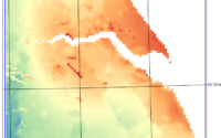
The geothermal potential of the Triassic Sherwood Sandstone Group in the Humber region was assessed using a multi-criteria GIS-based approach integrating geological, hydrological, heat demand and socio-environmental datasets. Ten normalised layers were combined to produce a regional geothermal potential map, with AI-assisted workflows supporting data selection, processing and weighting. Results indicate the highest geothermal potential along the Humber Estuary corridor, including Hull and Grimsby, where reservoir depths and heat demand are greatest. The analysis highlights key uncertainties and provides a transparent framework for discussion, sensitivity analysis and future site-specific studies. The methodology is transferable to geothermal assessments in other regions.
Due to circumstances beyond our control this lecture will now be held on Zoom at 7.30pm. Everyone on the YPS mailing list will receive the Zoom invitation a couple of days before the event.
This event will include the announcement of the 2026 John and Anne Phillips prize to a third year geologist from the University of Hull.
The presentation is available below and on the YPS YouTube channel:
Geothermal potential mapping of the Sherwood Sandstone small
Member’s report:
David Peacock from the University of Hull discussed how the geothermal potential of the Triassic Sherwood Sandstone Group in the Humber region was assessed using a map-based approach integrating geological, hydrological, heat demand and socio-environmental factors. Ten normalised layers were combined to produce a regional geothermal potential map, indicating the highest potential along the Humber Estuary corridor, including Hull and Grimsby, where both reservoir depths and heat demand are greatest. The analysis highlights the major uncertainties and provides a framework for discussion, sensitivity analysis and site-specific evaluations. Discussion included a question about the potential for electricity generation versus simply heating, with the answer that with engineering it is simpler and cheaper to use the heat rather than generating electricity, unless there are hot rocks close to the surface. A further discussion point centred on whether weighted addition or multiplication is the appropriate approach to combining individual maps, the latter being typically used for assessing spatial risk of zero potential.
Ru Smith
 Follow us on Twitter
 Like us on Facebook
 Follow us on Bluesky